

Clouds of the Day - April 26, 2020
/Satellite image from NOAA/NESDIS/STAR GOES-16 (East). Photos of today’s clouds will follow. For now, a field of cumulus clouds formed over the middle of Iowa into Minnesota. There is a chance for a few showers or thunderstorms to form within this area along with a small risk of “cold air” funnel clouds.

Satellite image courtesy of NOAA/NESDIS/STAR; https://www.star.nesdis.noaa.gov/star/index.php
Today’s solar radiation (graph on far right) shows a typical smooth steady rise during the morning. However, during the afternoon there are large changes in radiation receive at the ground due to passing clouds. As clouds covered the Sun the received radiation dropped dramatically. When the Sun was uncovered the amount received shot back up to where it would be if skies were clear. It’s easy to see how much the energy changes in 10-minute intervals. One of the changes show 939 watts per square meter dropping to 154 watts/square meter almost instantly.


The morning was clear but by Noon the first hints of cumulus clouds dotted the sky.

BEfore long little clouds grew bigger - from cumulus humilis (humble) to cumulus mediocris (mediocre).

Even though the cloud was only mediocre It was the big boy in a grouping of smaller cumulus
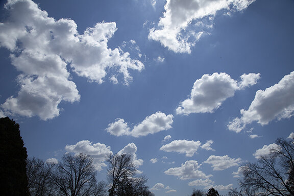
Nearby There were other clouds. They were growing in number and size

Looking east these cumulus were on the eastern edge of the cumulus field in the satellite photo above. In the distant east there were no clouds.

As the cumulus field expanded the cumulus mediocris clouds became more numerous.

Here is a close-up of a small be healthy cumulus. Notice the shadow from another nearby cumulus shading the left side of the cloud.

About an hour before sunset the cumulus were becoming smaller as their source of heat (the Sun) was getting lower in the sky and becoming less effective. Temperatures were cooling.

And finally other larger cumulus were also flattening and getting smaller. It’s been another day that started with clear skies before clouds covered more than one-half of the sky followed by clearing skies around sunset. The rising and setting of the sun played the dominate role of instigator of today’s clouds.