Less cloud cover, and much warmer
A WARMER WEDNESDAY
Cloud cover was a saving grace on Tuesday, shielding southeast Nebraska from some of the intense heat. We will see a lot less cloud cover on Wednesday, so there is a good chance we get very warm. Whereas Lincoln couldn’t even reach 90° on Tuesday, upper-90s are possible on Wednesday. A few spots may even reach 100°.

With the humidity factored in, we’ll see heat index values surpass 100° for a couple of hours during the afternoon. Peak heat indices may end up in the 105-110° range. This kind of heat can be dangerous if you’re not careful. Stay hydrated, take breaks, and find ways to cool off if you have to be outside for an extended period of time.

A Heat Advisory remains in effect for eastern Nebraska and will last through Friday for most of the orange-shaded counties. Western Nebraska is not included because the humidity will be slightly lower in that direction.

STORMS POSSIBLE TO THE WEST
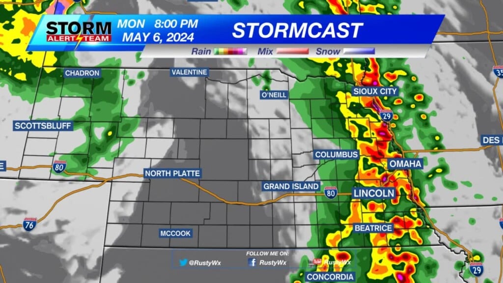
A frontal boundary will be positioned in western Nebraska on Wednesday afternoon. Storms may develop along this line.
A slight (Level 2/5) risk for severe weather is in place for southwest Nebraska. A marginal (Level 1/5) risk extends farther north and goes east up to the Tri-Cities. Damaging winds are the primary issue, with large hail being a secondary concern. The tornado threat looks slim to none. This will not be a widespread severe weather issue.

These storms will move east through the afternoon and into the evening. Eventually, we’ll lose the daytime heating effects and these storms will struggle to push into areas east of the Tri-Cities. Nevertheless, there may be just enough energy to force a few spotty storms overnight and into early Thursday in southeast Nebraska.
Meteorologist Malcolm Byron
Facebook: /mbyronwx
Twitter: @mbyronwx